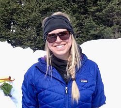
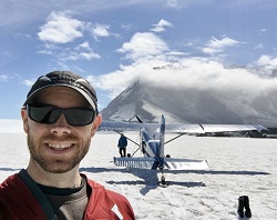
Snow variability in Thompson Pass, eastern Chugach Mountains, during CCHP's airborne photogrammetric survey in April of 2017. Photo credit: Katreen Wikstrom Jones, DGGS.
Mountainous regions collect enormous amounts of snow every year. Some of this snow accumulates to form glaciers. The rest of it melts and flows into rivers, lakes and the ocean. Measuring alpine snow depth helps us predict river flow, potential for flooding and impacts on fisheries. Given how important snow is for fish, wildlife, recreation and human activity, it is no surprise that scientists work hard to figure out just how much snow has landed on the ground. We use shovels and snow probes, but covering the vast Alaskan landscape this way is not possible. Fortunately we have two additional tools at our disposal. We measure snow from aircraft or from satellites (remote sensing), which gives us big-picture estimates of snow cover and depth, and we use computer models to simulate snow conditions based on atmospheric conditions.
Since spring of 2015, CCHP has conducted airborne photogrammetric surveys in Thompson Pass, eastern Chugach Mountains, to model snow surfaces and derive snow depth distribution. By differentiating snow depth between different years (acquired on more or less the same date in April every year), patterns in snow distribution can be determined and used to understand precipitation and melt rates, wind-loading, etc. During these remote sensing campaigns, CCHP also conduct field work on the ground; making snowpack depth and snow water equivalence (SWE) measurements across the modeled domain. These products are used by the Alaska Department of Transportation & Public Facilities to improve their avalanche forecasting along Richardson Highway. CCHP's collaborators at Oregon State University also use this information to calibrate snow water equivalence (SWE) in their hydrological modeling of spring water runoff for the region. Snow mapping surveys have also been conducted in Atigun Pass, and CCHP plans to conduct airborne snow mapping surveys in areas near Juneau and Turnagain Pass.
While remote sensing and computer models are very useful, they have their own limitations. Many satellite remote sensing snow mapping products are too course and lack the fine detail needed for many water resource management and hazard assessment applications. Through the Community Snow Observations (CSO) project, CCHP and their project partners use snowpack depth data submitted by community-based observers (citizen scientists), using the crowd-sourcing app MountainHub, to validate snow remote sensing products and water runoff models. This project aims to achieve a better understanding of snow depth variability in mountainous regions in the Pacific Northwest region of the contiguous United States and Alaska. Predicting and understanding variability in water runoff is important due to effects on snow avalanche hazards, water resources, ecology, tourism, and the impacts of a changing climate. The project is funded by NASA's Earth Science Program, as part of the NASA Citizen Science for Earth Systems project. The program complements NASA's capability of observing the Earth globally from space, air, land, and water by engaging the public in NASA's mission to "drive advances in science, technology, aeronautics, space exploration, economic vitality, and stewardship of the Earth". CCHP's partners in the project are University of Alaska Fairbanks, Washington State University, Oregon State University, and MountainHub.
Visit the CSO website for more information about the project and to get involved, and follow CSO on social media.
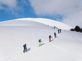
Community Snow Observations recruit backcountry recreationists to contribute snowpack depth information as they travel in the snow. Photo credit: Kevin Salys, Valdez Avalanche Center.
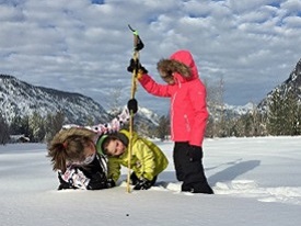
Citizen Scientists of all ages help gather snowpack depth information. Photo credit: David Hill, OSU.
Gabriel J. Wolken, Ph.D.
Climate & Cryosphere Hazards Program
Program Manager
Phone: 907-451-5018
Email: gabriel.wolken@alaska.gov
Katreen Wikstrom Jones, M.Sc.
Climate & Cryosphere Hazards Program
Hydrologist
Phone: 907-451-5006
Email: katreen.wikstromjones@alaska.gov