Informed coastal planning, facilitated by access to reliable decision-making tools, will help protect life, infrastructure, and the environment. DGGS projects that seek to close communication gaps, convert available data into a useful format, and educate the public about coastal processes, are designed to support decision-making and minimize losses due to new or exacerbated hazards in the coastal environment.
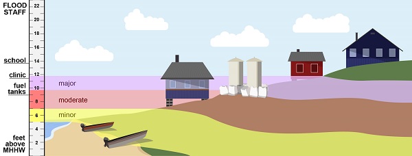
Flood risk category heights on an elevation staff (left) and contoured on a community.
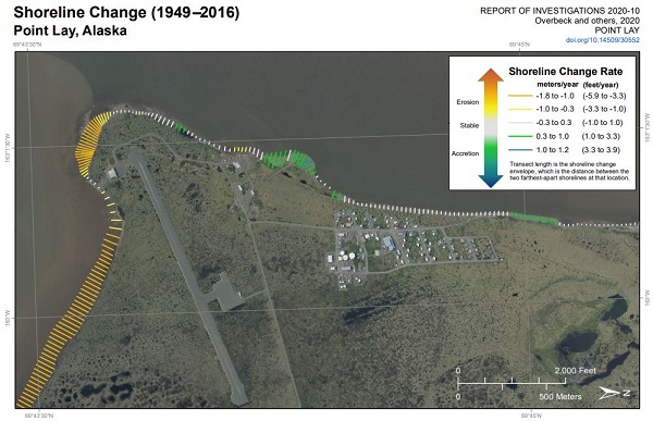
Clip of shoreline change map at Point Lay, Alaska
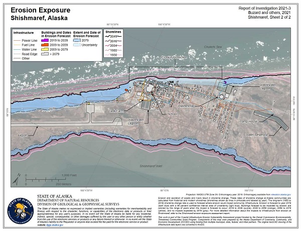
Clip of erosion exposure map from Shishmaref, Alaska.
Nora M. Nieminski
Coastal Hazards Program Manager
Phone: 907-754-3595
Email: nora.nieminski@alaska.gov