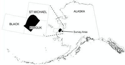
Burns, L.E., Emond, A.M., Zonge Engineering Research Organization, Inc., and Aerodat Inc., 2020, Airborne magnetic geophysical survey of the lower Yukon Delta, Alaska, data compilation: Alaska Division of Geological & Geophysical Surveys Geophysical Report 2020-14, 9 p. https://doi.org/10.14509/30460
 Report Information
 Geospatial & Analytical Data
| Lower Yukon Delta geophysical survey | Data File Format | File Size | Info |
|---|---|---|---|
| Download gpr2020_014_lower_ykd_1995_ascii_data | ASCII tabular files | 52.4 M | Metadata - Read me |
| Download gpr2020_014_lower_ykd_1995_databases_geosoft | Linedata Geosoft format database | 100.7 M | Metadata - Read me |
| Download gpr2020_014_lower_ykd_1995_documents | Adobe PDF files | 3.5 M | Metadata - Read me |
| Download gpr2020_014_lower_ykd_1995_grids_ermapper | Gridded data ER Mapper | 2.2 M | Metadata - Read me |
| Download gpr2020_014_lower_ykd_1995_grids_geosoft | Gridded data Geosoft format | 2.0 M | Metadata - Read me |
| Download gpr2020_014_lower_ykd_1995_images_registered | Image files | 10.4 M | Metadata - Read me |
| Download gpr2020_014_lower_ykd_1995_kmz | Google Earth files | 43.5 M | Metadata - Read me |
| Download gpr2020_014_lower_ykd_1995_maps_pdf_format | Adobe PDF files | 86.7 M | Metadata - Read me |
| Download gpr2020_014_lower_ykd_1995_vector_data | Vector data | 12.0 M | Metadata - Read me |
Aeromagnetic; Aeromagnetic Data; Aeromagnetic Map; Aeromagnetic Survey; Agcklarok; Ageklarok; Ageklekak; Airborne Geophysical Survey; Akulurak; Akumsuk; Alakanuk; Analytic Signal; Apoon; Apparent Resistivity Data; Apparent Resistivity Map; Apparent Resistivity Survey; Arovirchagk; Avogon Island; Blind Island; Chaniliut; Chifukluk; Choolunawick; Chulloonawick; Conductivity Survey; Electromagnetic Data; Electromagnetic Survey; Emangak; Emmonak; Exploration; First Vertical Derivative; Fish Village; Frequency Domain Electromagnetic Data; Geologic; Geology; Geophysical Map; Geophysical Survey; Geophysics; Geophysics Search Tag; Gridded Data; Hamilton; Kaluchagun; Kaluchagun Island; Kanelik; Kanyak River; Kawokhawik Island; Kothlik Island; Kotlik; Kotlik River; Kravaksanak; Kravaksarak; Kwiguk; Kwiklokchun; Kwikluak; Kwikpuk; Lamont; Line Data; Little Kotlik River; Magnetic Data; Magnetic Survey; Magnetics; Munson Island; Nagosakchowik; Naguchik; Nanvaranak Lake; Nelutahalik Creek; New Hamilton; Nililak; Nokogamiut Island; Nunaktuk Island; Nunam Iqua; Pastohk; Pastolik; Pastolik River; Pieneluk Island; Ponglevik River; Remote Sensing; Resistivity; Resistivity Survey; Tuchiak; Tukukapak; Yukon Delta; Yukon River; geoscientificInformation


