Flooding impacts many coastal communities in Alaska, yet the majority do not have a complete record of flood events. For this project, DGGS is compiling a list of all known floods for individual communities. The flood height is estimated using written accounts, photographs, historical and modern imagery, and elevation models. The current risk of flooding is determined by comparing historical flood extents to current infrastructure. Each community-specific report includes a flood risk category map showing current infrastructure and previous floods.
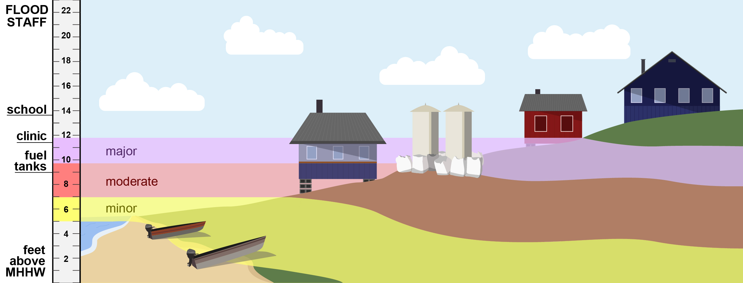
Flood risk category heights on an elevation staff (left) and contoured on a community.
The DGGS publication (coming soon) describes the overall project, method, results and maps for Golovin and Hooper Bay. DGGS is also developing an online tool to view flood risk categories, past flood extents, and current water level forecasts. Storm and flood photos are now hosted on the DGGS Photo Database.
To-date, on Golovin and Hooper Bay have completed maps, but more are in the works. Creating these maps requires a recently acquired elevation dataset tied to a tidal datum, and a great deal of effort goes in to estimating past storm heights. Thanks to funding from the Borough of Indian Affairs Tribal Resilience Program, the next flood assessments will include Alakanuk, Kotlik, and Napakiak.
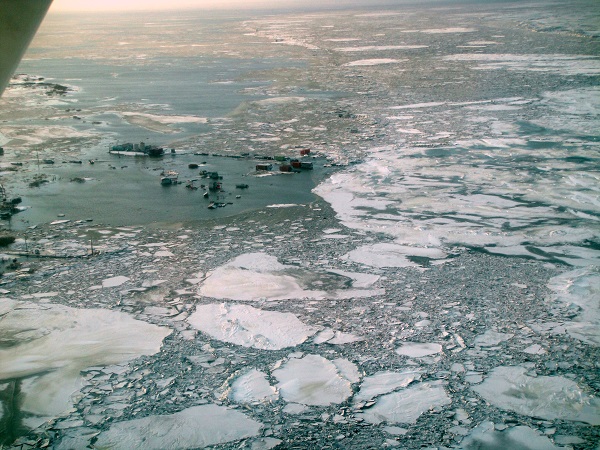
Flooding in Nunam Iqua during the November 2011 storm. Photo taken by Division of Homeland Security & Emergency Management.
This project was funded by the Alaska Ocean Observing System, National Oceanic and Atmospheric Administration Office for Coastal Management, and the State of Alaska.
For more information, contact Nora Nieminski and access the full report.
Nora M. Nieminski
Coastal Hazards Program Manager
Phone: 907-754-3595
Email: nora.nieminski@alaska.gov